
Published: November 8, 2025, 6:00 AM (PHST)
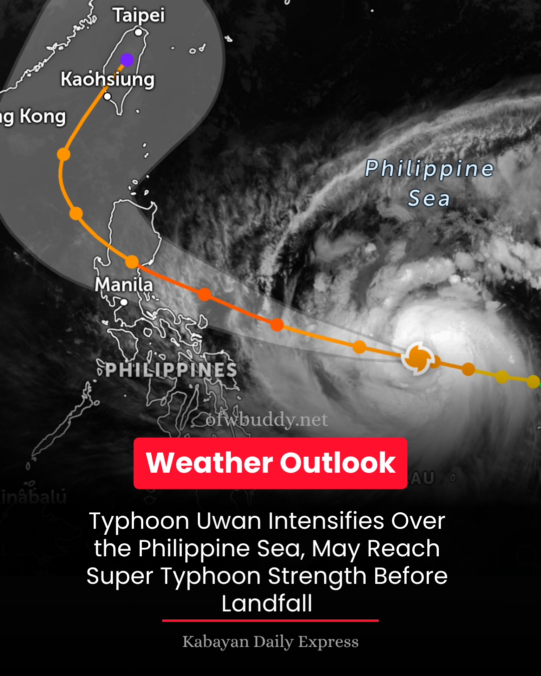
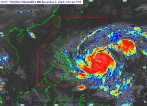
The Philippine Atmospheric, Geophysical and Astronomical Services Administration (PAGASA) reported early Saturday that Typhoon Uwan (international name: Fung-Wong) has further intensified as it continues to move west-northwestward over the Philippine Sea, east of Eastern Visayas.
As of 4:00 a.m., the center of Typhoon Uwan was estimated at 985 kilometers east of Eastern Visayas (12.4°N, 133.7°E), packing maximum sustained winds of 130 kilometers per hour (km/h) near the center, gustiness of up to 160 km/h, and a central pressure of 965 hPa. The typhoon is moving west-northwestward at 25 km/h.
Widespread Wind Signals Raised
PAGASA has raised Tropical Cyclone Wind Signal (TCWS) No. 2 over Catanduanes, parts of Northern Samar, Samar, and Eastern Samar due to the threat of gale-force winds within the next 24 hours.
Areas under Signal No. 1, including large portions of Luzon, the Visayas, and parts of Mindanao, may experience strong winds within 36 hours.
The weather bureau warned of minor to moderate impacts in areas under Signal No. 2 and minimal to minor impacts in areas under Signal No. 1.
PAGASA added that the highest signal that may be hoisted during Uwan’s passage could reach Signal No. 5, indicating possible super typhoon strength before landfall.

Possible Landfall in Northern Luzon
Based on the latest forecast track, Typhoon Uwan is expected to make landfall over the southern portion of Isabela or northern Aurora between late Sunday (Nov. 9) and early Monday (Nov. 10).
After landfall, Uwan will cross Northern Luzon’s mountainous terrain before emerging over the West Philippine Sea by Monday morning or afternoon.
The typhoon is forecast to rapidly intensify and may reach super typhoon category tonight or early Sunday. It is also expected to make landfall at or near its peak intensity.
Heavy Rain, Storm Surge, and Coastal Hazards Expected
PAGASA warned of life-threatening storm surges exceeding 3 meters in coastal areas of Isabela, Aurora, Quezon (including Polillo Islands), Camarines Norte, Camarines Sur, Catanduanes, Albay, Sorsogon, Northern Samar, and Eastern Samar within the next 48 hours.
A Gale Warning is in effect over the northern and eastern seaboards of Luzon and the eastern seaboard of Visayas.
Sea travel is risky for all vessels, with waves reaching up to 14 meters along the northern and eastern coasts of Catanduanes and Camarines Sur.
Public Advisory
Residents in low-lying and mountainous areas, especially those under TCWS, are urged to prepare for heavy rainfall, flooding, landslides, and strong winds.
Disaster risk reduction offices are advised to implement pre-emptive evacuations where necessary and closely monitor updates from PAGASA.
The public is encouraged to follow official advisories from PAGASA and local government units. The next Tropical Cyclone Bulletin will be issued at 11:00 a.m. today.