
Philippines — December 5, 2025
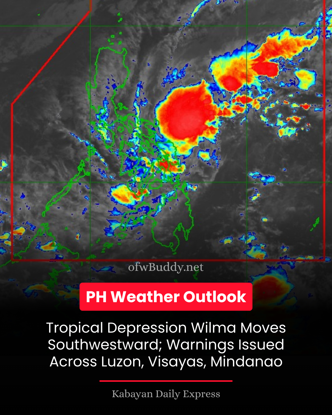
The Philippine Atmospheric, Geophysical, and Astronomical Services Administration (PAGASA) has issued Tropical Cyclone Bulletin No. 5 for Tropical Depression Wilma, which continues to move southwestward while maintaining its current strength.
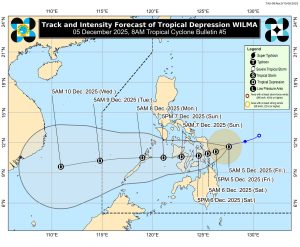
As of 7:00 a.m., the center of Wilma was located 235 kilometers east of Borongan City, Eastern Samar (11.6°N, 127.6°E), with maximum sustained winds of 45 km/h near the center, gusts up to 55 km/h, and a central pressure of 1004 hPa. The depression is moving southwest at 15 km/h, with strong winds extending up to 220 km from its center.
Areas under Tropical Cyclone Wind Signal No. 1 include parts of Luzon (southern Masbate), Visayas (including Northern Samar, Eastern Samar, Samar, Leyte, Cebu, Bohol, Negros Occidental and Oriental, Siquijor, Iloilo, Capiz, and Guimaras), and Mindanao (Surigao del Norte, Dinagat Islands, northern Surigao del Sur, northern Agusan del Norte, and Camiguin). Residents are advised that strong winds of 39–61 km/h may pose minimal to minor threats to life and property.
PAGASA warned that the Northeast Monsoon will continue to bring strong to gale-force gusts across most of Luzon and Visayas today, extending to Zamboanga Peninsula and Misamis Occidental over the weekend.
Coastal hazards: Gale Warnings are in effect for the northern and western seaboards of Northern Luzon, as well as the eastern seaboards of Luzon and Visayas. Sea conditions are expected to be very rough, with waves reaching up to 5.5 meters in some areas. Mariners are strongly advised to remain in port or seek safe harbor and avoid venturing out to sea, especially small vessels and motorbancas.
Forecast and precautions: Wilma is expected to move west-southwest until December 6 before turning westward, possibly making landfall over Eastern Visayas or Dinagat Islands between Thursday evening and Friday morning. It will continue across Visayas and may pass over northern Palawan by Monday, December 8. The tropical depression may slightly intensify before landfall and could strengthen further once over the West Philippine Sea.
PAGASA urged the public, especially those living in high-risk areas, to take precautionary measures and follow local evacuation instructions. Residents are advised to monitor local weather advisories for updates on heavy rainfall, strong winds, and other hazards.
The next tropical cyclone bulletin for Wilma will be issued at 11:00 a.m. today.