
November 9, 2025 | Manila, Philippines
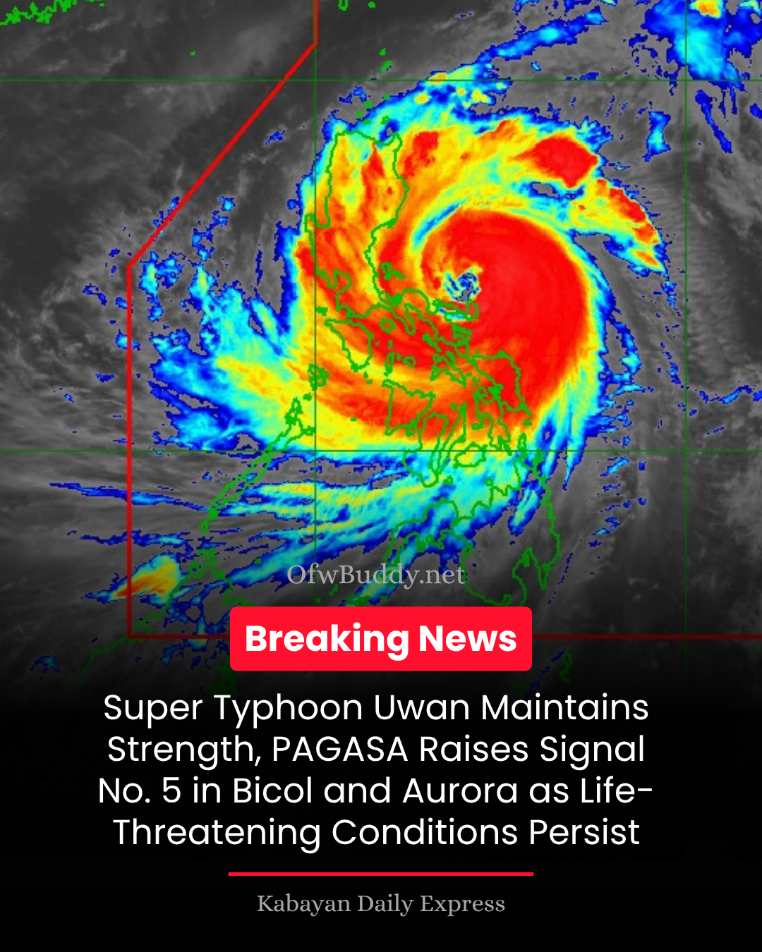
The Philippine Atmospheric, Geophysical and Astronomical Services Administration (PAGASA) announced in its Tropical Cyclone Bulletin No. 10 issued at 11:00 AM, Sunday (November 9, 2025), that Super Typhoon Uwan (international name: Fung-Wong) continues to maintain its peak intensity while bringing life-threatening winds, rain, and storm surges across the Bicol Region and Central Luzon.
🌀 Current Status
As of 10:00 AM, the center of the eye of Super Typhoon Uwan was located over the coastal waters of Pandan, Catanduanes (14.3°N, 124.4°E).
-
Maximum sustained winds: 185 km/h near the center
-
Gustiness: up to 230 km/h
-
Central pressure: 935 hPa
-
Movement: West northwestward at 30 km/h
-
Wind radius: Typhoon-force winds extend up to 800 km from the center
⚠️ Tropical Cyclone Wind Signals (TCWS)
Signal No. 5 (Extreme Threat – Typhoon-force Winds)
Areas under Signal No. 5 are expected to experience winds exceeding 185 km/h, posing extreme danger to life and property within the next 12 hours.
Affected areas:
-
Central portion of Aurora (San Luis, Baler, Maria Aurora, Dipaculao)
-
Polillo Islands
-
Northern Camarines Norte (Daet, Talisay, Paracale, Vinzons, Jose Panganiban, Mercedes, Basud)
-
Eastern Camarines Sur (Siruma, Caramoan, Garchitorena, Tinambac, Lagonoy)
-
Catanduanes
Signal No. 4 (Severe Threat – Typhoon-force Winds)
Includes portions of Isabela, Quirino, Nueva Vizcaya, Aurora, Nueva Ecija, Bulacan, Pampanga, Quezon, Camarines Norte, Camarines Sur, and Albay, where wind speeds could reach up to 184 km/h.
Signal No. 3 (Storm-force Winds)
Now in effect over Metro Manila, Central Luzon, CALABARZON, Benguet, Ilocos Region, and Northern Samar, where destructive winds between 89–117 km/h may be felt within 18 hours.
Signal No. 2 and No. 1
These are raised in Visayas and Mindanao regions, including Eastern Samar, Leyte, Cebu, Negros, and Surigao provinces, with possible gale- to strong-force winds.
🌧️ Heavy Rainfall and Flooding
PAGASA warns that heavy to torrential rains will persist over Bicol, Aurora, Quezon, and Northern Samar, likely resulting in flooding and landslides.
Residents in mountainous and low-lying areas are urged to evacuate immediately and heed advisories from local disaster management offices.
🌊 Storm Surge and Coastal Flooding
Life-threatening storm surges exceeding 3 meters are expected within the next 48 hours in coastal communities of:
Cagayan, Isabela, Aurora, Zambales, Bataan, Pampanga, Bulacan, Metro Manila, Cavite, Batangas, Quezon, Camarines provinces, Catanduanes, Albay, Sorsogon, Northern and Eastern Samar, and Dinagat Islands.
🌊 Sea Travel and Maritime Warnings
A Gale Warning remains in effect across almost all Luzon and Visayas coasts, with waves reaching up to 14 meters in open seas.
All sea travel is suspended, and mariners are advised to seek safe harbor immediately.
🗺️ Track and Forecast
Super Typhoon Uwan is expected to move west northwestward, passing close to Calaguas and Polillo Islands today before making landfall over central Aurora tonight or early Monday.
After crossing Northern Luzon, the typhoon will likely weaken but remain strong as it exits via Lingayen Gulf or La Union on November 10 (Monday) morning.
By Wednesday (November 12), Uwan will begin moving toward Taiwan, where it could make landfall on Thursday, before weakening into a tropical depression near the Ryukyu Islands.
🛑 Safety and Evacuation Reminder
PAGASA and local authorities strongly urge residents in high-risk areas to:
-
Evacuate early if advised by LGUs.
-
Stay away from coastal areas.
-
Keep updated through official bulletins and announcements.
-
Avoid travel until conditions improve.
The next Tropical Cyclone Bulletin (No. 11) will be released at 2:00 PM today.