
📍 Philippines | November 7, 2025, 5:00 PM Update
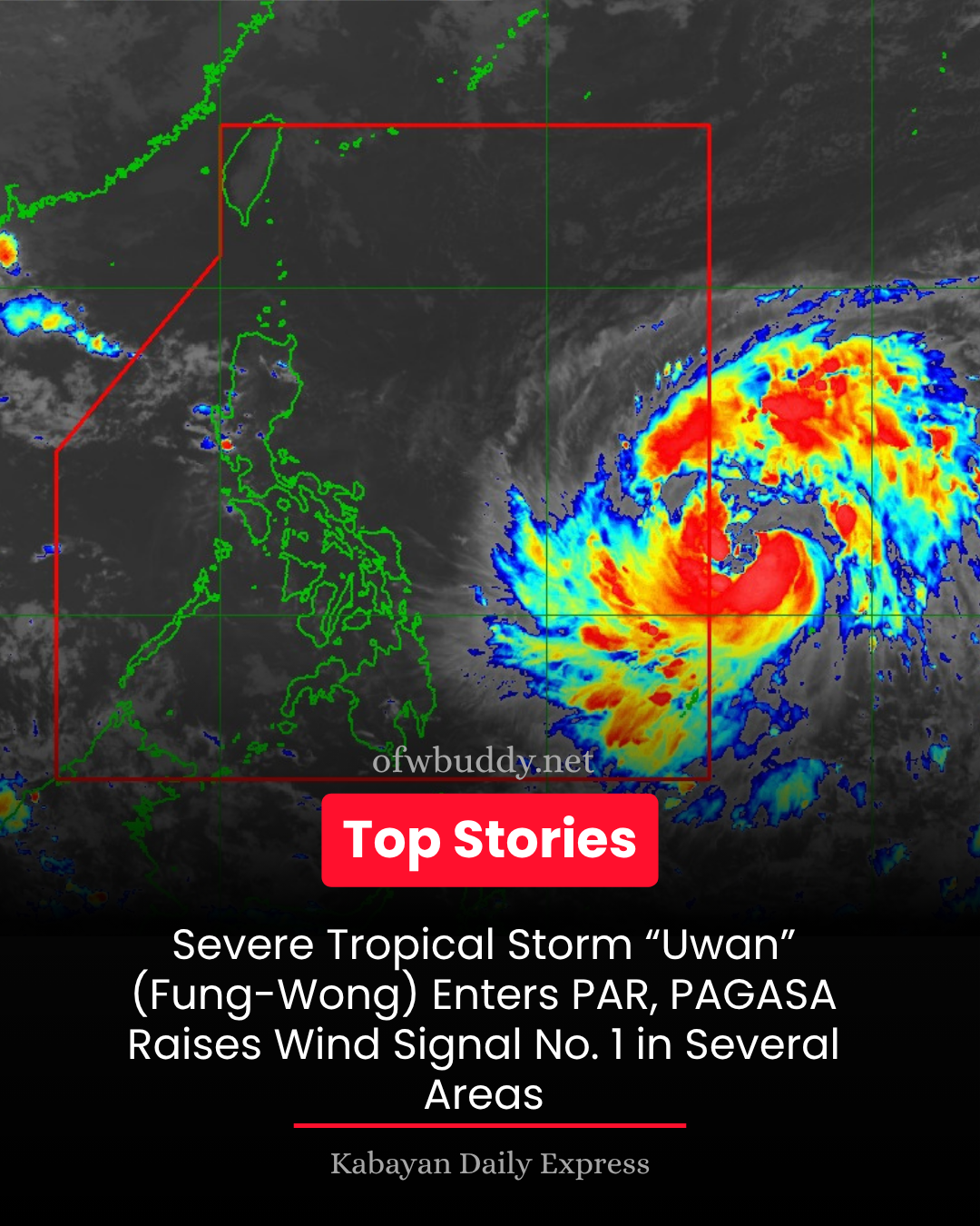
The Philippine Atmospheric, Geophysical and Astronomical Services Administration (PAGASA) announced that Severe Tropical Storm Fung-Wong has entered the Philippine Area of Responsibility (PAR) and was given the local name “Uwan.” The weather bureau has hoisted Tropical Cyclone Wind Signal (TCWS) No. 1 over several provinces in Luzon, Visayas, and Mindanao.
🌪 Current Situation
As of 4:00 PM, the center of Severe Tropical Storm Uwan was located 1,175 km east of Eastern Visayas (11.6°N, 136.2°E).
-
Maximum sustained winds: 110 km/h near the center
-
Gustiness: Up to 135 km/h
-
Central pressure: 975 hPa
-
Movement: Westward at 25 km/h
-
Wind extent: Strong to storm-force winds extend up to 780 km from the center
⚠️ Areas Under TCWS No. 1
Wind threat: Strong winds (39–61 km/h) within 36 hours, posing minimal to minor threats to life and property.
Luzon:
Southeastern Quezon, Romblon (east), Camarines Norte, Camarines Sur, Catanduanes, Albay, Sorsogon, Masbate
Visayas:
Northern Samar, Eastern Samar, Samar, Biliran, Leyte, Southern Leyte, northern and central Cebu (including Bantayan & Camotes Islands), northeastern Bohol, northern Negros Occidental, northeastern Capiz, northeastern Iloilo
Mindanao:
Dinagat Islands and Surigao del Norte
🌧 Rainfall and Wind Outlook
-
Heavy rains are expected across the Visayas and parts of Mindanao beginning Saturday, November 8.
-
Strong to gale-force winds may also be experienced in coastal and upland areas even outside the signal areas.
-
The highest possible wind signal to be raised during Uwan’s passage is Signal No. 5, PAGASA warned.
🌊 Coastal Hazards and Storm Surge
PAGASA warned of life-threatening storm surges and coastal flooding, especially along the east coast of Central and Southern Luzon and parts of Northern Luzon.
-
Gale warnings will likely be issued along the eastern seaboards of Luzon, Visayas, and the Caraga region by tonight or tomorrow morning (November 8).
-
Sea travel is dangerous due to very rough to high seas reaching 5.0 meters in some eastern coastal waters.
-
Mariners of small vessels are strongly advised to remain in port.
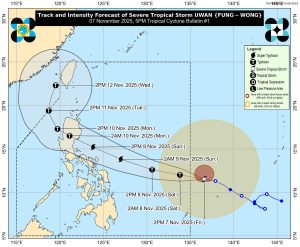
🧭 Forecast Track and Intensity
Uwan is expected to enter the PAR tonight or early Saturday (November 8) and move west-northwestward.
-
Potential landfall: Over the southern portion of Isabela or northern Aurora by Sunday evening (November 9) or early Monday (November 10).
-
The system may rapidly intensify into a typhoon within 24 hours and possibly reach super typhoon category before landfall.
-
After crossing Northern Luzon, it is expected to exit toward the West Philippine Sea by Monday.
🚨 Public Advisory
PAGASA urges the public, especially residents in flood-prone and mountainous areas, to take precautionary measures and coordinate with local disaster risk reduction offices.
Those in highly susceptible areas are advised to prepare for possible evacuation.
For localized forecasts, rainfall warnings, and storm surge advisories, visit the PAGASA website.
📢 The next Tropical Cyclone Bulletin will be issued at 11:00 PM today.