
TROPICAL CYCLONE ADVISORY NO. 9
Severe Tropical Storm FUNG-WONG
Issued at 11:00 AM, November 7, 2025
Valid for broadcast until the next bulletin at 11:00 PM
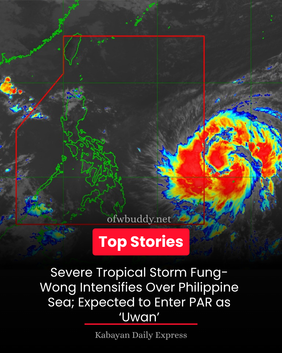
🌊 “FUNG-WONG” Further Intensifies Over the Philippine Sea Northeast of Palau
Location of Center (as of 10:00 AM):
The center of Severe Tropical Storm FUNG-WONG was estimated at 1,315 km east of Eastern Visayas (outside PAR), near coordinates 11.6°N, 137.5°E.
Intensity:
-
Maximum sustained winds: 100 km/h near the center
-
Gustiness: Up to 125 km/h
-
Central pressure: 980 hPa
Movement:
Moving west-northwestward at 20 km/h
Extent of Winds:
Strong to storm-force winds extend outward up to 720 km from the center.
🌀 Forecast and General Outlook
-
Track:
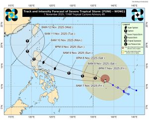
FUNG-WONG is expected to move generally west-northwestward throughout the forecast period. It is forecast to enter the Philippine Area of Responsibility (PAR) either late tonight or early Saturday morning (November 8). Once inside PAR, it will be locally named “Uwan.”The storm is forecast to make landfall over the southern portion of Isabela or the northern portion of Aurora by late Sunday evening (November 9) or early Monday morning (November 10). After crossing Northern Luzon’s mountainous terrain, it will likely emerge over the West Philippine Sea by Monday morning or afternoon.
-
Intensity:
FUNG-WONG is projected to rapidly intensify, reaching typhoon category within 24 hours and possibly super typhoon strength by Saturday night or Sunday morning. It could make landfall at or near its peak intensity.
⚠️ Hazards Affecting Land Areas
-
Wind Signals:
Tropical Cyclone Wind Signals (TCWS) may be raised over portions of Southern Luzon, Eastern Visayas, and Caraga Region as early as this afternoon or evening.
The highest possible wind signal under the current forecast is Signal No. 5. -
Weather Conditions:
Deteriorating weather may begin Sunday (November 9).
Potentially life-threatening storm conditions are expected in Northern and parts of Central Luzon on Monday (November 10) and Tuesday (November 11).
There is also a high risk of storm surges and coastal flooding, particularly along the northern, eastern, and southern Luzon coasts. PAGASA may issue storm surge warnings as early as Saturday.
🌊 Marine Hazards
-
Today to Tomorrow:
Moderate to rough seas over the northern and eastern seaboards of Luzon and eastern seaboards of Visayas and Mindanao. -
Weekend Conditions:
Western and southern seaboards of Luzon may experience moderate to rough seas by Saturday or Sunday.
Starting Sunday onward, very rough to phenomenal seas may affect most of Luzon and the eastern seaboards of Visayas and Mindanao.
Gale warnings for hazardous coastal conditions are likely to be issued tomorrow.
📢 Public Advisory
Residents, especially in Northern and Central Luzon, are strongly advised to stay alert and monitor official updates from DOST-PAGASA.
Local government units and disaster response offices should prepare for potential evacuations, flooding, and power disruptions.
The next Tropical Cyclone Advisory will be issued at 11:00 PM today, unless an intermediate bulletin is released.
Source: DOST-PAGASA
#FungWongPH #UwanPH #PAGASA #WeatherUpdate #LuzonAlert #RescuePH