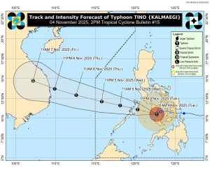
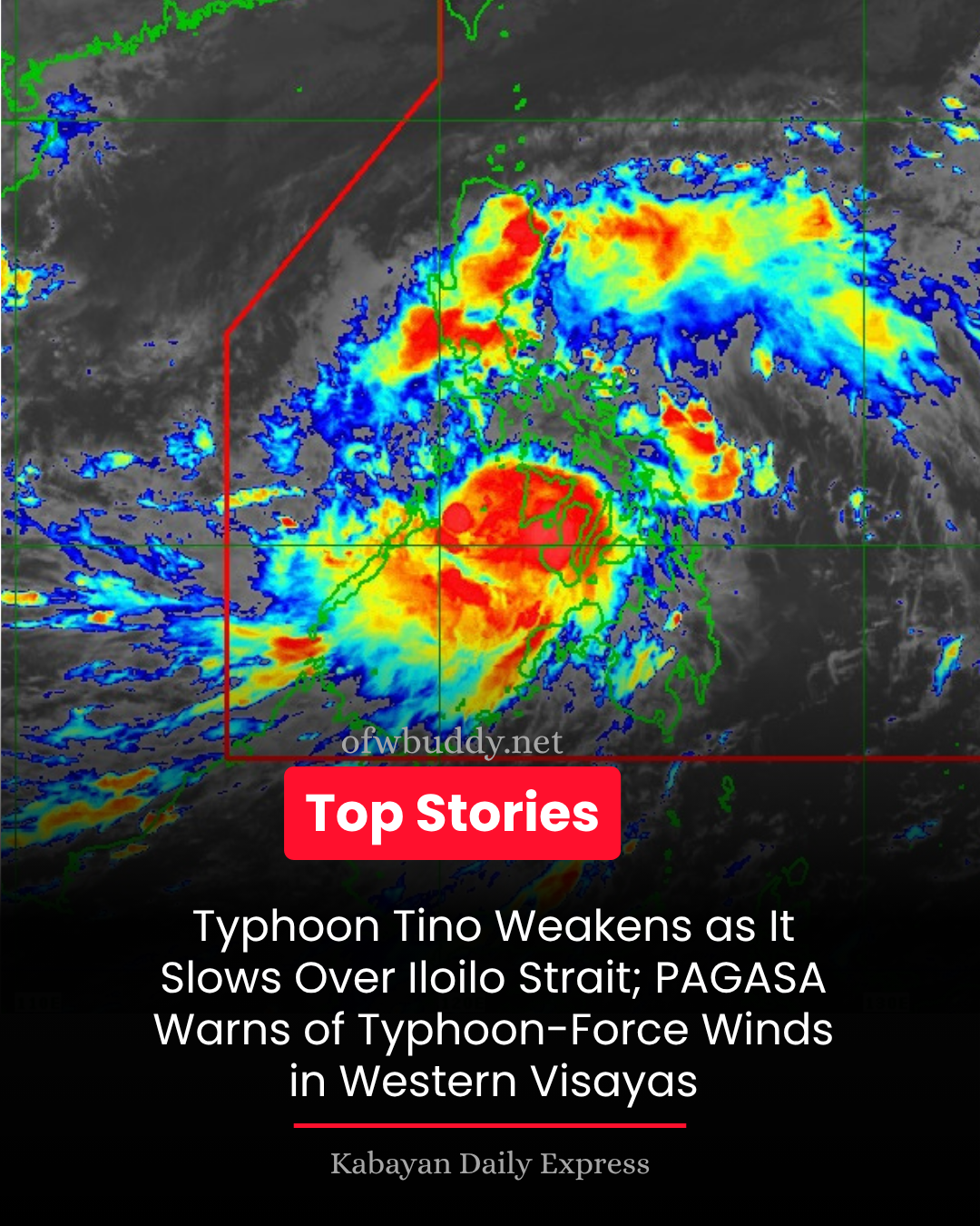
The Philippine Atmospheric, Geophysical and Astronomical Services Administration (PAGASA) reported that Typhoon Tino (Kalmaegi) has slightly weakened as it slowed down over Iloilo Strait on Tuesday afternoon, November 4, 2025.
In its Tropical Cyclone Bulletin No. 15 issued at 2:00 PM, PAGASA said the center of Tino’s eye was located over the coastal waters of Jordan, Guimaras (10.6°N, 122.5°E). The typhoon now carries maximum sustained winds of 130 km/h near the center, gusts of up to 180 km/h, and a central pressure of 970 hPa, moving west-southwest at 20 km/h.
Areas Under Tropical Cyclone Wind Signals
Signal No. 4 – Typhoon-force winds (118–184 km/h)
-
Cuyo Islands
-
Central and southern portions of Antique (including San Jose, Sibalom, Bugasong, and others)
-
Central and southern Iloilo (including Iloilo City, Oton, Tigbauan, Miagao, and nearby municipalities)
-
Guimaras Province
Residents under Signal No. 4 are warned of significant to severe threats to life and property, with potential for widespread damage from strong winds and storm surge.
Signal No. 3 – Storm-force winds (89–117 km/h)
-
Calamian Islands and northern Palawan
-
Aklan, Capiz, northern and central Negros Occidental
-
Northern Negros Oriental (Guihulngan, Canlaon City, Vallehermoso, and nearby towns)
Moderate to significant threats are expected, including uprooted trees and structural damage to light materials.
Signal No. 2 – Gale-force winds (62–88 km/h)
-
Portions of Masbate, Mindoro, Romblon, Palawan, Cebu, Negros Oriental, and Bohol
Signal No. 1 – Strong winds (39–61 km/h)
-
Parts of Quezon, Marinduque, Albay, Sorsogon, Samar, Leyte, and Siquijor
Heavy Rainfall, Storm Surge, and Coastal Flooding
PAGASA warned that heavy rainfall and coastal flooding remain possible due to the combined effects of the shear line, northeast monsoon, and Typhoon Tino’s circulation.
Low-lying and coastal areas in Romblon, Mindoro, Palawan, and Western Visayas may experience life-threatening storm surges exceeding 3 meters within the next 24 hours.
Sea travel is considered risky to all types of vessels as waves may reach up to 6 meters over the Calamian and Cuyo Islands, and up to 5 meters along the coasts of Antique, Iloilo, Aklan, Capiz, and Guimaras.
Forecast Track and Outlook
After crossing Guimaras, Tino is forecast to move across Western Visayas and northern Palawan before emerging into the West Philippine Sea by Wednesday morning, November 5. The system is expected to exit the Philippine Area of Responsibility (PAR) by Wednesday night or early Thursday morning.
Although weakening slightly due to land interaction, PAGASA said Tino will likely re-intensify over the sea. The agency advised residents in affected regions to remain alert and coordinate with local disaster risk reduction and management offices (DRRMOs) for possible evacuation and emergency measures.
Public Advisory
PAGASA urges the public to closely monitor official updates through:
-
Weather Advisory No. 12 for rainfall outlook
-
Storm Surge Warning No. 9
-
Gale Warning No. 4
The next Tropical Cyclone Bulletin for Typhoon Tino (Kalmaegi) will be issued at 5:00 PM today.
Summary
-
Typhoon Name: Tino (Kalmaegi)
-
Location (as of 1:00 PM): Coastal waters of Jordan, Guimaras
-
Winds: 130 km/h sustained, 180 km/h gusts
-
Movement: West-southwest at 20 km/h
-
Next Bulletin: 5:00 PM, November 4, 2025