
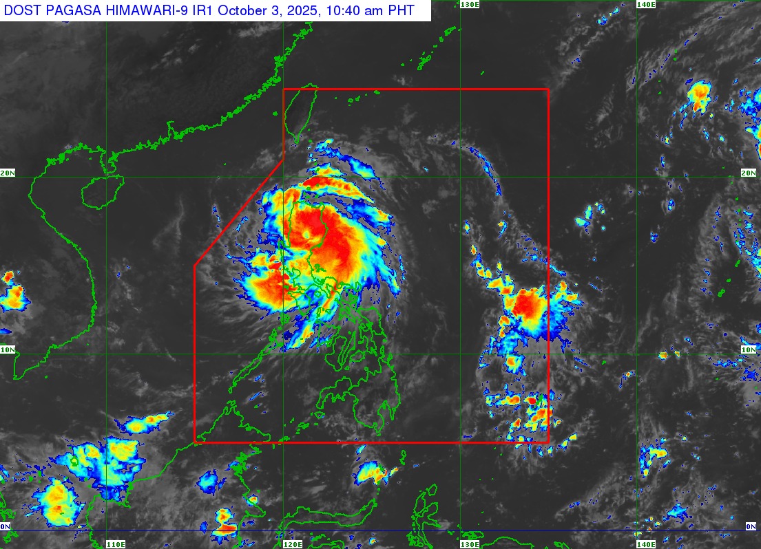
MANILA, Philippines (October 3, 2025, 11:00 AM) — Typhoon Paolo (international name: Matmo) intensified further as it made landfall in Dinapigue, Isabela Friday morning, bringing destructive winds, heavy rains, and life-threatening coastal conditions across Northern and Central Luzon, according to the Philippine Atmospheric, Geophysical and Astronomical Services Administration (PAGASA).
As of 10:00 AM, the eye of Typhoon Paolo was located in the vicinity of San Guillermo, Isabela with maximum sustained winds of 130 km/h, gusts reaching 215 km/h, and a central pressure of 975 hPa. The storm is moving west-northwest at 25 km/h and is expected to cross Northern Luzon before exiting into the West Philippine Sea later today.
Wind Signals Raised
PAGASA has placed several provinces under Tropical Cyclone Wind Signals (TCWS):
-
Signal No. 4 (Storm-force winds, 118–184 km/h): Parts of Isabela, Quirino, Nueva Vizcaya, Aurora, Ifugao, Mountain Province, northern Benguet, southern Ilocos Sur, northern La Union, and portions of Abra.
-
Signal No. 3 (89–117 km/h): Other parts of Isabela, Quirino, Nueva Vizcaya, Benguet, Kalinga, Abra, Ilocos Sur, and La Union.
-
Signal No. 2 (62–88 km/h): Portions of Cagayan, Apayao, Ilocos Norte, Pangasinan, Aurora, and Nueva Ecija.
-
Signal No. 1 (39–61 km/h): Remaining areas of Cagayan, Babuyan Islands, Quezon including Polillo Islands, Zambales, Tarlac, Pampanga, Bulacan, Camarines Norte, and Batanes.
PAGASA warned that typhoon-force winds under Signal No. 4 pose a significant to severe threat to life and property, while storm- and gale-force winds under Signals No. 3 and 2 may cause moderate damage.
Rainfall and Storm Surge Threats
Typhoon Paolo is expected to bring intense rainfall over wide areas of Northern and Central Luzon. PAGASA has also warned of a moderate to high risk of storm surges of 1.0 to 3.0 meters in coastal areas of Ilocos, La Union, Pangasinan, Zambales, Cagayan, Isabela, Aurora, and Quezon, which may cause flooding in low-lying communities.
Sea conditions remain dangerous, with waves reaching up to 7.0 meters off Isabela and up to 6.0 meters in the eastern seaboard of Cagayan. PAGASA strongly advised fishermen and small vessels to remain in port, as sea travel is risky for all types of watercraft.
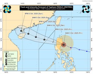
Forecast and Advisory
Paolo is projected to weaken slightly as it passes through the mountainous terrain of Northern Luzon, but it may re-intensify once over the West Philippine Sea, where it is forecast to exit the Philippine Area of Responsibility (PAR) by tomorrow morning, October 4.
Authorities urged residents in flood-prone and landslide-prone areas to heed evacuation orders and monitor updates from local disaster management offices. PAGASA stressed that even areas outside the direct landfall point may still experience heavy rains, destructive winds, and coastal inundation.
The next tropical cyclone bulletin will be issued at 2:00 PM today.